Free trial Sign in
  1. Mapping it out

    Records can describe how farms and villages have developed into industrial towns and cities, yet all you can witness today are bricks and concrete. A map, however, provides a visual snapshot frozen in time and can better demonstrate the social and economic layout of a community’s hidden past. As importantly, any accompanying schedules, are an indispensable way of identifying what has gone before

    Here are a few examples for you to discover a community footprint for your project:

    • Enclosure maps and awards – these maps capture changes in the landscape particularly where stripe of agricultural land develop into larger enclosed fields. The award can identify ownership of land and thus providing valuable family information.
    • Tithe map and apportionments – colourful large-scale tithe maps show each building, church, pathway and stream and more. The schedule of apportionment gives details of the owner and occupier along with a description of the plot plus the amount of rent-charge. The plot numbers cross reference the numbering of plots on both the map and the apportionment schedule.
    • Estate maps and rental schedules– commissioned by landowners to capture the extent of their estate, these wonderful maps contain details of houses, fields and woodlands, often with the names of adjacent landowners. If you’re lucky there may be an accompanying rental schedule giving names of tenants and their land and cottage plus the amount of rent.
    • Ordnance survey – historical ordnance survey maps are incredibly useful and suit both rural and urban areas. They are ideal in tracking demolition and development throughout the centuries.
    • Fire Insurance Plans and Registers – these town plans were commissioned to identify potential liability in the event of a fire and were updated every few years. Where accompanied by fire registers, personal information can be obtained about the policy holder: name, address and occupation together with details of the construction and value of the property. These are held by the Guildhall Library and the British Library.
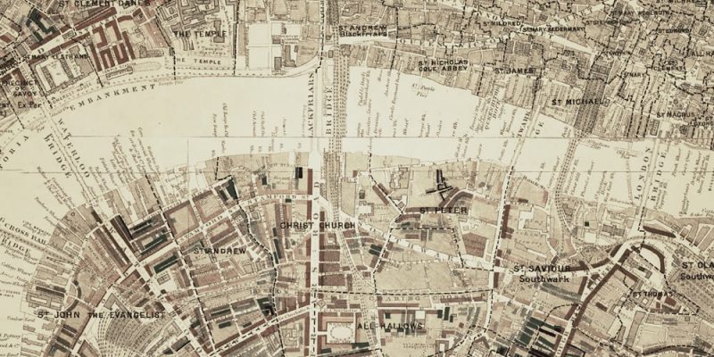
    • Charles Booth’s Poverty Maps and notebooks – In essence these social class maps are specific for East End communities in London. Together with data collected from police officers on their London beats, Stepney Union casebooks and Jewish notebooks offer a rich insight to life in the 1880s and 1890s. Our image for this blog has been taken from https://booth.lse.ac.uk
    • Valuation Office Survey, Valuation and Field Books – these records relate to a survey carried out between 1910-1915 which are useful for identifying property ownership, value, use, tenancy and date of erection by consulting the plan and fields books at the National Archives, Kew (TNA).
    • The National Farm Survey and Primary Farm Records – carried out between 1941-1943, these records give more recent information on farmland, farmers and farm workers and are held at TNA. Useful to chat with locals who have living farming memories.
    • Alan Godfrey Maps – reprints of old ordnance survey maps comprising more than 3,000 titles so far. Accompanied by a description of the area or a selection from the trade directory. http://www.alangodfreymaps.co.uk

    Maps should be used in conjunction with other maps and records such as census, GRO certificates, wills, trade directories, old postcards and title deeds to establish a location and identify family relationships. Discover online maps for convenience, however nothing beats the scale and feel of old hand-drawn cartography. Visit the National Archives, Local Archives, Diocesan Archives and Libraries to find out for yourself.
  2. Every last drop

    Family Historians are familiar with squeezing out every possible fact from primary evidence such civil registration certificates and wills. Any extra information gleaned is a bonus and can extend a pedigree by providing, say with a birth certificate, such information as the mother’s maiden surname. Equally, a marriage certificate may identify the name of the father of the bride and groom along with witnesses and of course a death certificate should state not only who registered the death but also the cause. Finally, if you’re fortunate and can locate a will, then sometimes up to three generations can be mentioned as beneficiaries in a will as well as bequests made to favoured servants and friends.

    Examination of records for a one-place study are conducted with a slightly different outlook. Whilst scrutinising a community as a whole, people can be discovered where you’d least expect. Always be on the look out to uncover the unexpected.

    Instead of searching for the name of a person in the online catalogue of a local archives, diocesan record office or specialist repository, an alternative search should be focussed on the place.

    A plethora of records will become apparent which may not have been considered when looking for a person:

    • Board of Education returns
    • Private lunatic asylums
    • Ordnance survey sheets
    • Lease and release
    • Bargain and sale
    • Friendly Society records
    • Glebe terriers

    … and many more.

    Although the emphasis shifts from tracing ancestors to witnessing the development of a community, these records can provide evidence that places an individual in a specific time and a place which may not have been apparent from the census 1841-1911.

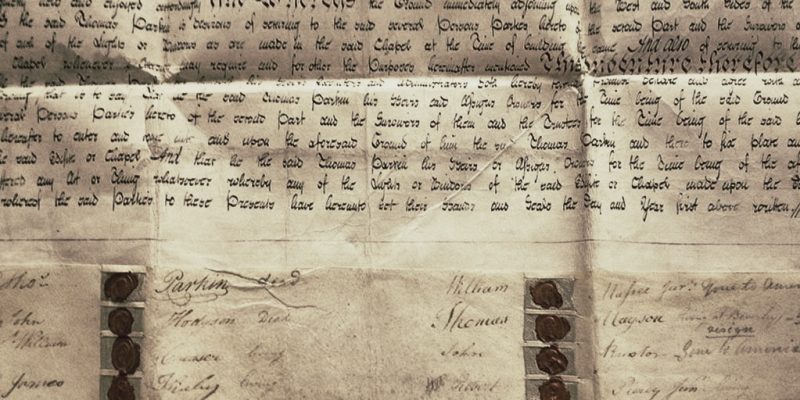
    The deed in the above photograph records the parties named in the purchase of land for a Methodist chapel in 1803. The signatures of the trustees are recorded at the bottom of the page along with their seals. By the time the trustees were updated, a note explained the current status of the signatories i.e. deceased, resigned and gone to America.

    By using Name & Place you can import the document image and record the details of some of the members of the Methodist congregation. You can identify the parties and who were trustees thus narrowing down the date of their death and emigration, building an holistic overview of a small section of the village, land earmarked for building and inhabitants who were nonconformists.

    By encompassing all record types in its data repository, with full indexing, Name & Place enables matches to be found in more obscure documents. Using its full search capabilities, you can manually locate based on person or place names but we’re also employing intelligent matching to try to suggest possible connections you may not have noticed across all datasets.

  3. Wish you were here

    Regular social media followers of Name and Place will realise how fond we are of old postcards – they ARE names and places!

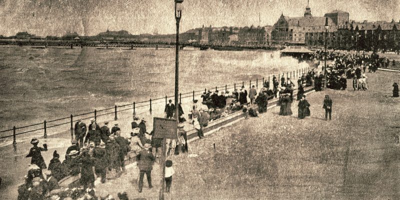
    An old postcard of your one-place study or where your ancestors lived, can be a precious gem amongst your treasure chest of images. In the absence of any photographs, an old postcard can solve mysteries of vanished properties and a way of life. Buildings can often give a clue why the road was named as it was; Union Place (workhouse), Railway Street (disused railway) and Stonefall Avenue (disused quarry). They are invaluable when studying the history of a property with visual evidence such as bricked up windows, ghostly outlines of business signs visible through paintwork or even the reason why an extension was added. Old postcards capture trades, businesses, post offices and schools at a moment in time. You could be even luckier with the bonus of proprietors proudly stood outside their butchers, bakers and candlestick maker shops with decorative signs overhead.

    Turning over the postcard, it may well contain the handwriting of a person you’re connected with in a community. There can be a goldmine of genealogical facts; names, addresses, postmarks, family links ‘Dear Auntie’ etc. Many people simply used postcards for a quick message just to show where they had been visiting or when they would be arriving. Sending birthday greetings was also a favourite.

    Try an online search from the many providers available. You may grab a bargain or even be tempted to bid high for a valuable image. Good hunting!