Defining a boundary
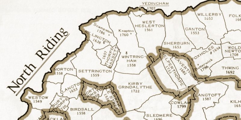
The definition of a boundary is important as it sets the compass for the way forward. To know the edges of your chosen place will help you locate the county records office, local archives, diocesan or specialist archives where all the lovely records are deposited. Also it helps resist the temptation to move beyond the set boundary and prevent the study getting out of hand. Straying beyond a defined boundary is another study.
A street, hamlet, village or small town may be a choice. In parish registers of marriage, it is common to see ‘o.t.p.’ which stands for ‘of this parish’. In some cases, studies are formed from the parish boundary. By way of example, the parish of Rillington (St. Andrew) is within the union of Malton and the wapentake of Buckrose in the East Riding of Yorkshire and the parish contains the township of Rillington and the chapelry of Scampston. Following reorganisation of Local Authority boundaries in 1974, Rillington is now in North Yorkshire. Historical records for a chosen place may be lodged in different local archives over time due to boundary changes, sometimes in a different county.
There are many websites to help you define your boundary such as genuki.org and familysearch.org.
There are no rules regarding setting up and managing a One-Place Study, as every study is as individual as its topography and inhabitants.
Walk the boundary of your chosen area and the lanes just like ancestors did in the ancient custom of ‘beating the bounds’. Notice the buildings, fields, rivers and public footpaths which make a study unique and creates a distinction and enhancement to the traditional records of family history.
Get your boots on and define your boundary.
The parish map for the East Riding of Yorkshire is reproduced with permission of the Institute of Heraldic and Genealogical Studies in Canterbury. The original map may be found in the Phillimore Atlas & Index of Parish Registers 3rd Edition, by Cecil R. Humphrey-Smith.